The haukāinga (local residents) of the Rotorua area – Te Arawa, Tūhourangi and Ngāti Wāhiao – have lived in this highly active geothermal region for generations. The unique geology of the area ...
After the success of offshore islands in protecting our native species, mainland islands were introduced and have proved to be a successful conservation strategy. The process includes creating an ...
Resource management identifies the natural environment as a resource that needs to be protected and restored. New Zealand’s native biodiversity is unique. The high percentage of species found ...
In this activity, students use the Ake Ake model to explore changes that have taken place in their local environment in the last 50–100 years and to plan for the next 50 years. By the end of this ...
In this activity, students research three aspects of biodiversity loss – direct species loss, habitat loss and pests and weeds. By the end of this activity, students should be able to: discuss ...
In this activity, students research the effect of common pollutants on our waterways and hold a mock trial to determine the worst pollutant in the country. By the end of this activity, students ...
Backyard Battle is a citizen science programme run by Keep New Zealand Beautiful. It gets students, teachers, volunteers and other citizen scientists out collecting litter at key inland sites ...
Globe at Night is an international citizen science campaign to raise public awareness of the impact of light pollution by inviting citizen scientists to measure and submit their night sky ...
Loss of the Night is an international citizen science project aiming to quantify the illumination of the night sky caused by artificial light. By monitoring how bright the night sky is over time ...
About 70% of Earth’s surface is covered by water. It is found just about everywhere and is the only naturally occurring substance on Earth existing in solid, liquid and gas states. Water is ...
Students carry out a practical investigation to help AgResearch scientists monitor the spread of Microctonus aethiopoides (a tiny wasp) and its success as a biocontrol agent for clover root ...
With 75% of New Zealanders living within 10 km of the coast, many students will be familiar with estuaries. In scientific terms, estuaries are the interface between the land and the sea – the ...
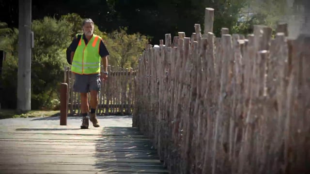
Rotorua is world famous for its geothermal features. For generations, local Māori used the hot pools with little impact on the natural system. As Rotorua’s population grew, unsustainable amounts ...
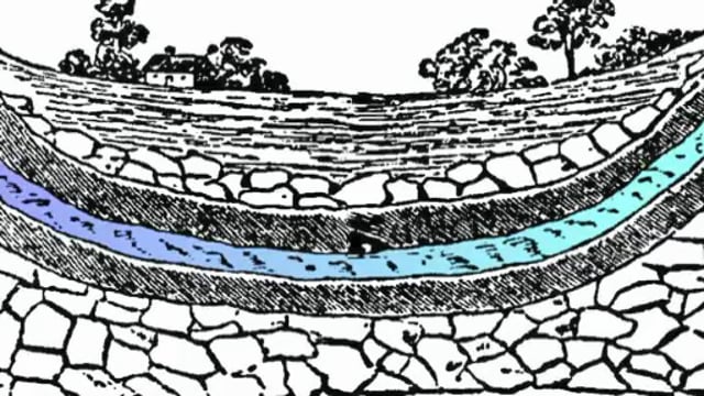
In this video, educator Angela Schipper demonstrates how to build a model of an aquifer – a layer of rock or other material that carries water underground. This is an excellent activity that ...
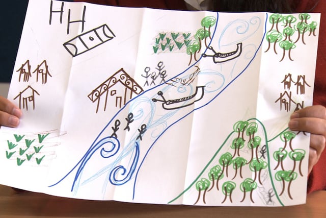
The Ake Ake model is a pictorial mapping of someone’s perspective. Researcher Lorraine Dixon uses the model to encourage iwi to share their views including values and possible issues around ...
Dr Candida Savage explains the clues she collects in estuaries and fiords, to understand how changes in land use affect these environments.
Tirohia ngā rautaki e ora tonu ai ngā arawai mō ērā kei te taha whakararo o te wai me ngā ika taketake, waihoki ka whaihua hoki ngā pāmu, e kore ai hoki e heke iho ngā putanga.
This timeline lets you see the historical developments in technology related to weather monitoring, measuring and forecasting. It also shows how scientific thinking changed over the centuries as ...