Since the global positioning system (GPS) became fully operational in the mid-1990s, it’s widely used to navigate, map and survey land as well as study the small changes in movement of objects on ...
Base isolation is a technique developed to prevent or minimise damage to buildings during an earthquake. It has been used in New Zealand, as well as in India, Japan, Italy and the USA. A ...
Scientists think that about 14 billion years ago (that is a 14 followed by 9 zeros), this universe came into being through the Big Bang. This is described in the Big Bang theory. It is thought ...
In this activity, students take on the roles of seismologists, vulcanologists and geographers, using maps to look for patterns in the worldwide distribution of earthquakes, volcanoes and ...
The series of activities described below was designed to help students develop an understanding about earthquakes in New Zealand, including why we get them and how we measure them. The world of ...
In this activity, students use maps to plot a graph of earthquakes under New Zealand to show the shape of the North Island subduction zone and compare this to the distribution of earthquakes in ...
Large snow events in most parts of New Zealand are uncommon. However, if you are in the South Island or the central North Island, this citizen science project could be a great one for your ...
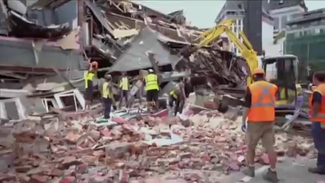
About 14,000 earthquakes are recorded in and around New Zealand every year. Canterbury’s 7.1 and Kaikōura's 7.8 magnitude earthquakes and subsequent aftershocks show the constant threat ...
Long ago, according to the legend of Māui, the Sun was the focus of attention. People wanted more daylight and warmth to get their jobs done. Māui schemed to harness the Sun. Scientists today ...
In this online PD session recorded on 2 June 2016, Andrea Soanes from the Science Learning Hub was joined by three guest presenters – all inspirational women working in STEM – who shared their ...
New Zealand gets lots of earthquakes every year. Some earthquakes are very strong. Scientists study earthquakes to keep us and our important buildings safe. Point of interest The black and white ...
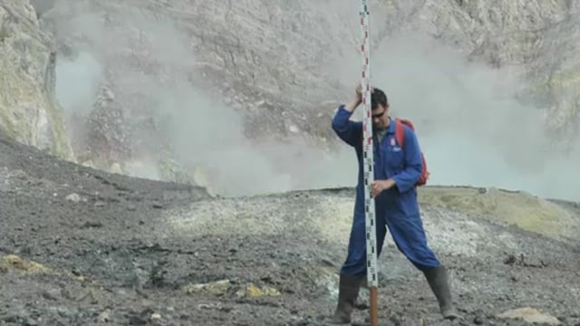
All the volcanoes in New Zealand are monitored for activity so that scientists can determine when the next eruption might be. Dr Jan Lindsay introduces us to the monitoring system and how it ...
Chris Gannon and Dr Bill Robinson of Robinson Seismic explain the base isolation principle. We can make buildings strong so they don’t fall down, but is that the best form of earthquake ...
The size, orbit and design of a satellite depend on its purpose. In this interactive, scientists discuss the functions of various satellites and orbits. Accompanying fact files provide ...
This interactive looks at the electromagnetic spectrum.
Use this interactive to identify the components of a modern landfill system. Drag and drop the text labels onto the diagram.