Using super sense technology, changes in the Earth’s structure can be measured without having to actually be there: Motion sensors called seismographs record tremors or small earthquakes that ...
Since the global positioning system (GPS) became fully operational in the mid-1990s, it’s widely used to navigate, map and survey land as well as study the small changes in movement of objects on ...
Artificial sensors and probes enable us to overcome the limitations of our human senses and extend them in novel and useful ways, using the scientific concepts of electricity and waves. Find out ...
In this activity, students explore the transit method of searching for planets. They plot graphs of light measurements from stars, searching for dimming that indicates the presence of a planet ...
In this activity, students use a simple true or false interactive tool to categorise facts. This activity could be used as a formative activity to gather students prior knowledge and ...
In this activity, students observe how the Moon appears to move across the sky each hour, as well as over several days. They discuss how both the rotation of the Earth as well as the satellite ...
Globe at Night is an international citizen science campaign to raise public awareness of the impact of light pollution by inviting citizen scientists to measure and submit their night sky ...
Loss of the Night is an international citizen science project aiming to quantify the illumination of the night sky caused by artificial light. By monitoring how bright the night sky is over time ...
Search data from NASA’s Kepler spacecraft for the dips in star light intensity caused by exoplanets – planets that orbit stars other than the Sun. As these exoplanets pass between the star and ...
In this online PD session recorded on 13 August 2015, secondary school teacher Steve Chrystall describes how he uses the Science Learning Hub’s satellites and rocket resources to teach space and ...
Children’s involvement in science is increased when they have an opportunity to make decisions about science-based issues that have consequences for their lives. It’s bringing science into the ...
Are you looking for ways to teach forces? If you’re new to the Science Learning Hub, you may want to start with our introductory video on teaching physics. Alternatively, use the links below to ...
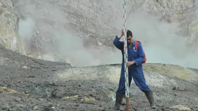
All the volcanoes in New Zealand are monitored for activity so that scientists can determine when the next eruption might be. Dr Jan Lindsay introduces us to the monitoring system and how it ...
Prof Richard Haverkamp of Massey University gives an introduction to how the famous 19th century scientist Michael Faraday made an early step towards nanoscience.
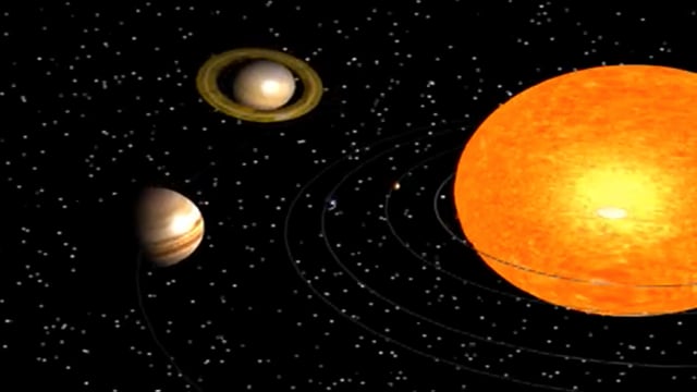
Dr Allan McInnes and Dr Adrian McDonald, from the University of Canterbury, explain how gravity and projectile motion keep natural and artificial satellites in an orbital path.
The size, orbit and design of a satellite depend on its purpose. In this interactive, scientists discuss the functions of various satellites and orbits. Accompanying fact files provide ...
Watch this animation of Mars that shows all the major features of the Martian topography.
Use this interactive graphic organiser to highlight common alternative conceptions about gravity and satellites. Students can place the labels where they think they belong. This activity can be ...